Remote sensing from Earth’s orbit
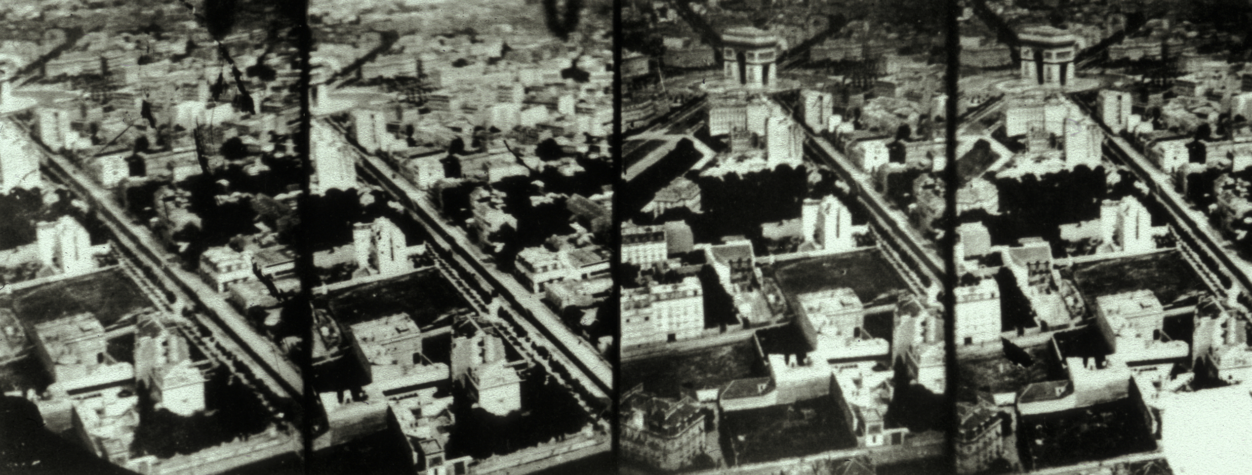
When in 1868, Nadar set out to capture among the first aerial photographs of his day little did he know that his endeavor marked the beginning of now over 150 years of airborne image-taking. Nadar took his photographs out of a balloon, but other methods such as attaching cameras to pigeons or kites soon followed and figured as indicators of one of the hallmarks of aerial photography and related imaging techniques: that of constant innovation. Consequently, after the second world war and the coming of the bipolar world order, aerial photography was already implemented for military purposes at high sophistication. (→ Fig.1)
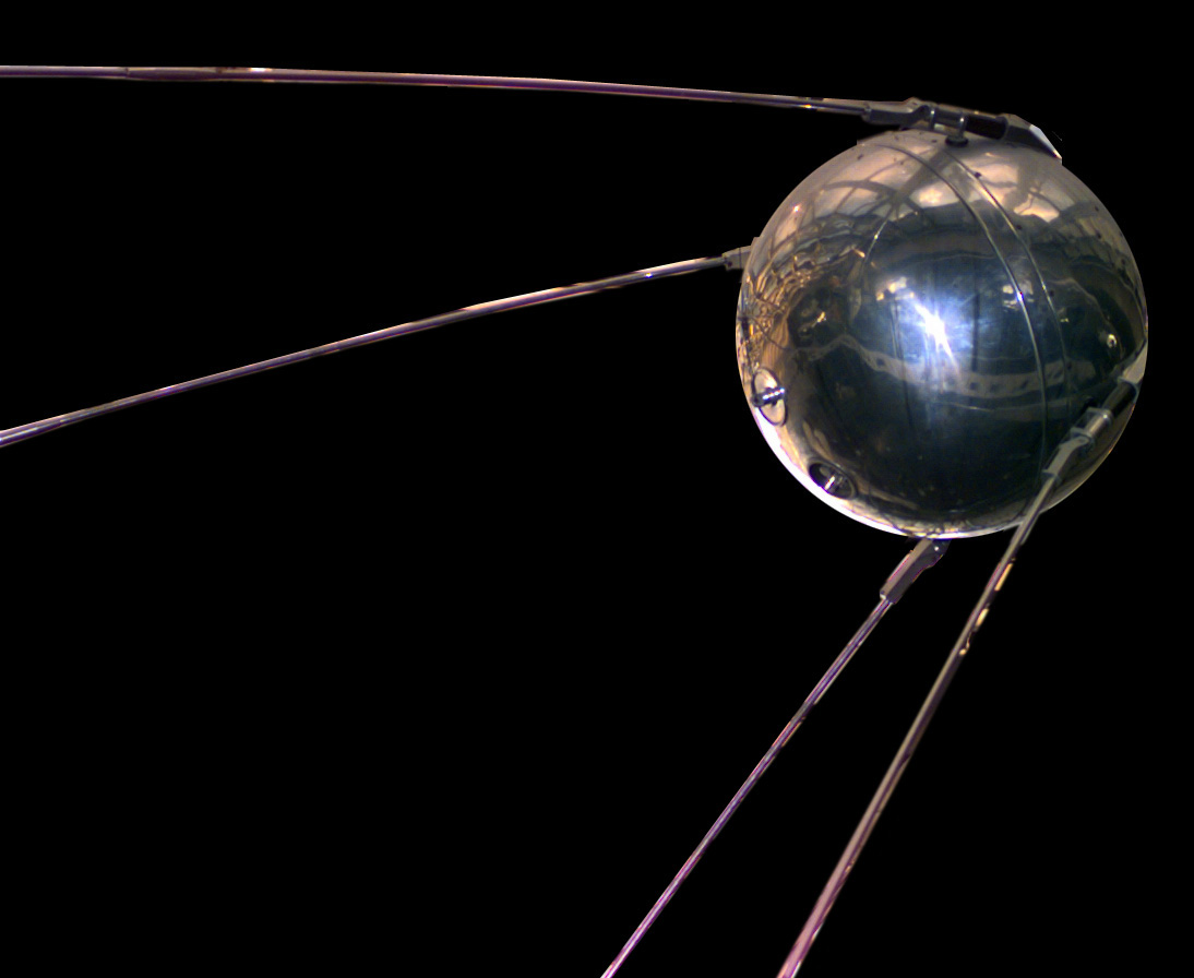
In conjunction with the already soaring technological innovations of the 20th century, the arms race between the United States and the Soviet Union made way for the development of the first artificial satellites. Usually, the word satellite refers to a machine that is launched into space and moves around Earth or another body in space, but in astronomical terms, a satellite is a moon or planet that orbits a planet or star. Hence in 1957, the Soviet Union successfully launched Sputnik 1 as the first human-made satellite into an elliptical low Earth orbit and with it instigated the space race – a competition for the lead in spaceflight capability between the United States and the Soviet Union. After Sputnik 1, subsequent satellites often carried sensory systems that made it possible to observe the earth from low earth orbit. Such instruments refer to the broader practice of remote sensing – a process whereby physical characteristics of an area are being detected and monitored by "measuring its reflected and emitted radiation at a distance from the targeted area." (→ Ref.1) (→ Fig.2)
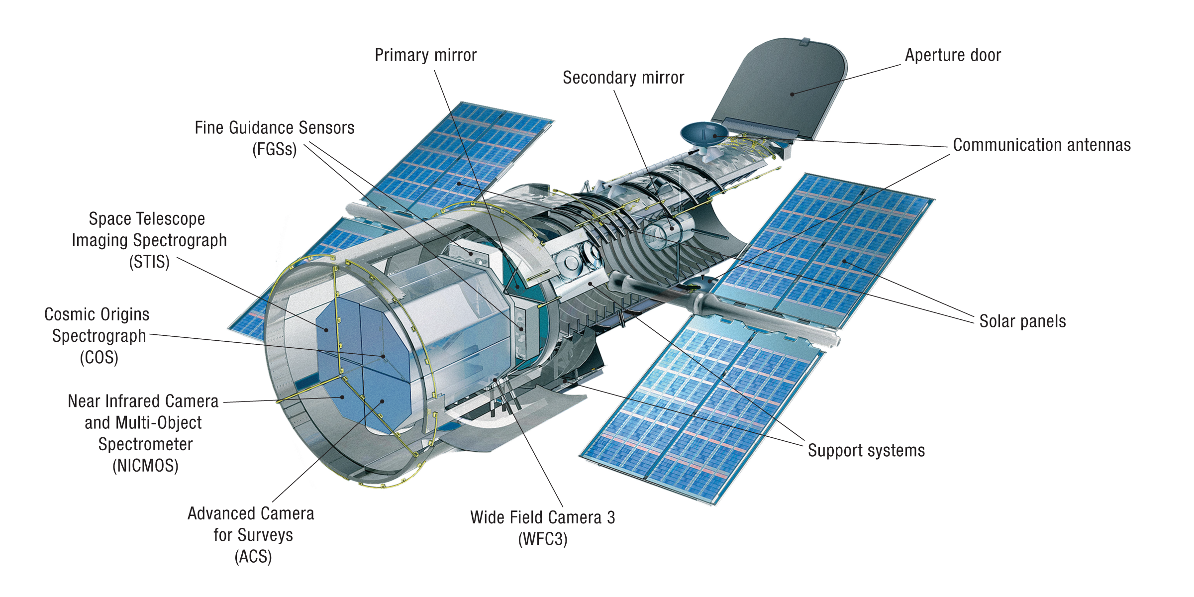
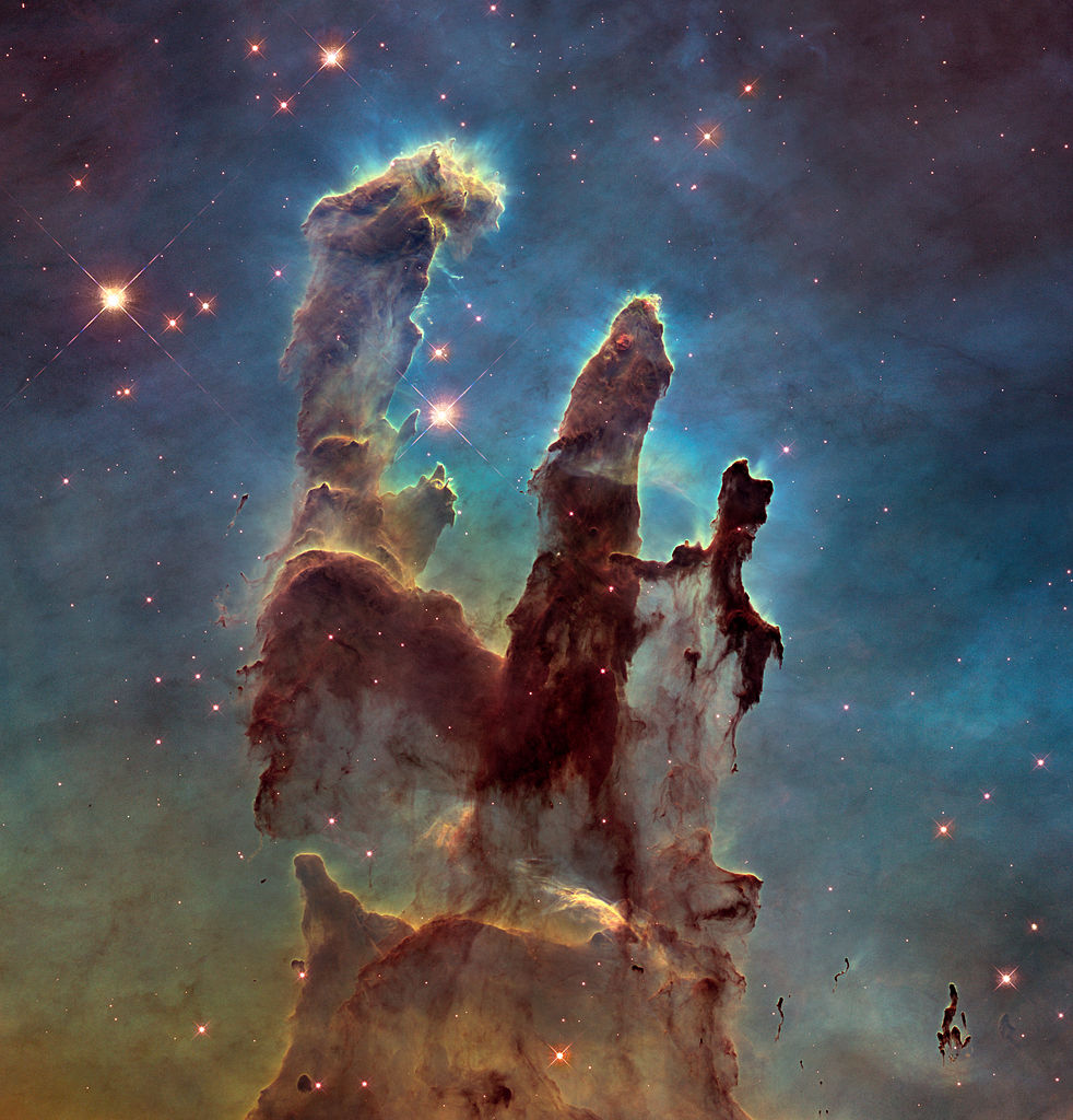
It comes as no surprise that the capability to observe Earth from space is closely linked to technological innovations for military needs, but ultimately, the continuous improvement of spacial, radiometric and spectral sensors has percolated to the civic sector, such that these technologies have not only led to a better understanding of the Earth's climate system but also to an understanding of Earth's place in the universe. One of the most prolific achievements in remote sensing technology is the Hubble Space Telescope (HTS) that was launched in 1990. To this day, data derived from the HTS delivers some of the most impressive imagery from deep space. The HTS also figures as a case in point when it comes to the highly automated nature of remote sensing processes – a circumstance that nowadays is almost universally true for remote sensing technology. (→ Fig.3 & 4)
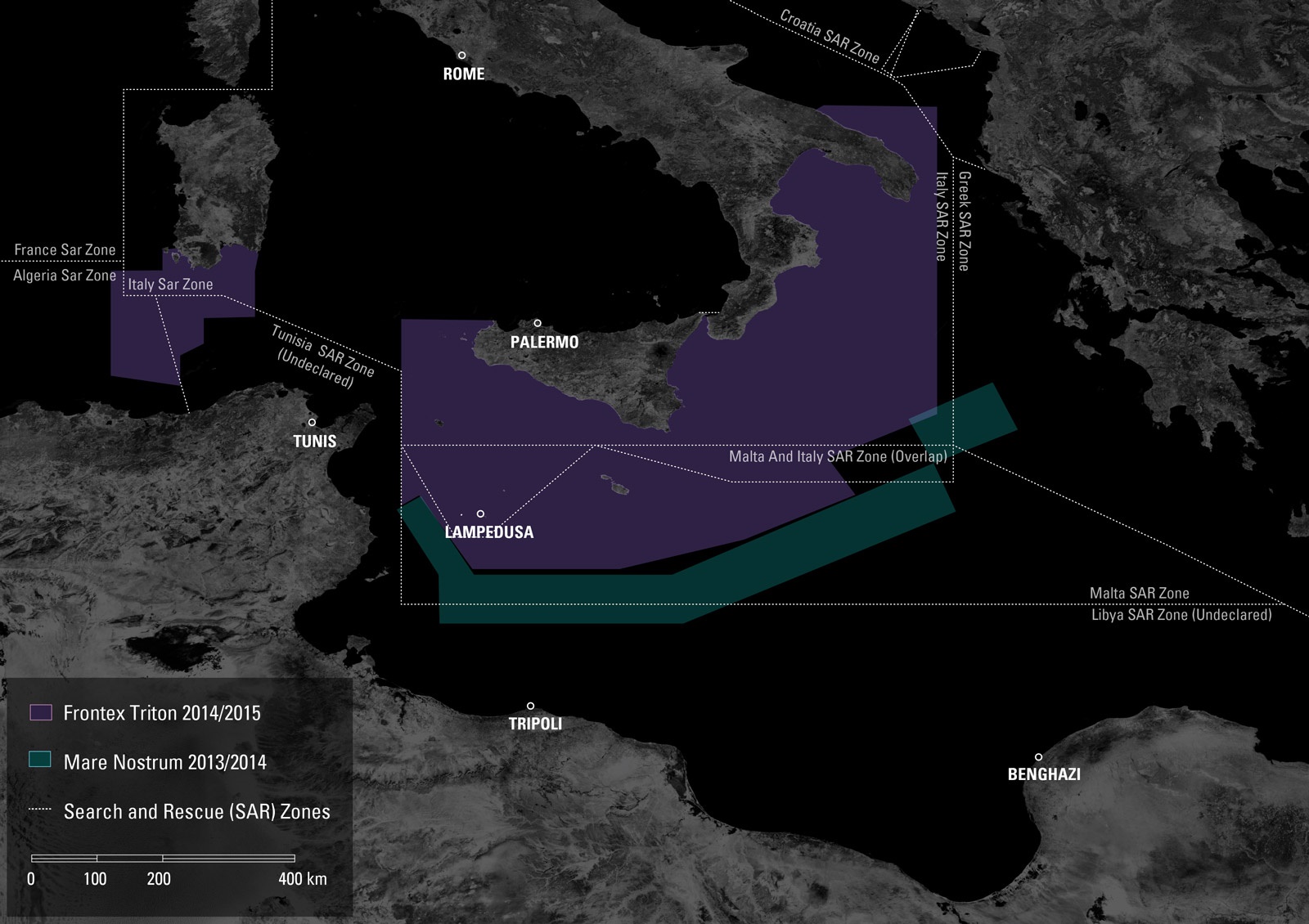
With the ongoing downscaling of computer hardware, it has become possible to develop miniature-sized satellites that vastly extend the traditional capabilities of artificial satellites such as earth observation, scientific research, navigation, and communication. And whereas in the 20th-century state entities took it upon themselves to push the development of these technologies, nowadays private companies and universities are at the forefront of advancing satellite technology. In addition to maintaining and advancing the backbone of Earth's communication and navigation systems, such institutions continue the decades-long quest for providing fundamental insights in various physical science fields. In 2011, the United Nations Global Pulse initiative–a flagship innovation initiative of the United Nations Secretary-General on big data–stated that when it comes to the study of "human and socioeconomic processes, satellite remote sensing is an incredibly powerful tool that is underutilized." (→ Ref.2) Sure enough, much has happened s ince 2011, but one of the main hindrances of remote sensing data remains its accessibility to the general public. Time and time again, the true potential of openly available satellite data becomes apparent when groups like the agency for forensic architecture (FA) in London make massive use of remote sensing data to produce and present architectural evidence–relating to buildings, urban environments–within legal and political processes. Their work has been presented in various "investigations in international courtrooms, parliamentary inquiries, United Nations (UN) assemblies, as well as in citizens’ tribunals and truth commissions." Furthermore, their investigations have been widely exhibited in art and cultural institutions all over the world and as such have been hinting at the artistic potential of satellite data. Other artists such as Mishka Henner (→ Feedlots) and Páraic McGloughlin (→ Arena) have primarily worked with satellite imagery as a means of a novel perspective on global phenomena, but Global Pulse's remark from 2011 certainly still rings true for the arts in that these tools have not yet been fully exploited let alone explored. (→ Fig.5)
Ref.1 Usgs.gov. (2019). What is remote sensing and what is it used for?. [Accessed 14 Nov. 2019].
Ref.2 Unglobalpulse.org. (2019). Social Impact through Satellite Remote Sensing - Visualizing Acute and Chronic Crises beyond the Visible Spectrum | United Nations Global Pulse. [Accessed 14 Nov. 2019].
Image sources:
Fig.1 NADAR, Aerial view of Paris, 1868, Arc de Triomphe
Fig.2 NSSDC/NASA, Sputnik 1 replica, 2004
Fig.3 STScI/NASA, Hubble Instruments Cutaway, 2019